Since the COVID-19 situation has changed rapidly over the past 1-2 weeks and people are now seriously avoiding public transport, there seem to be many more people people riding bikes around Melbourne.
Many of them seem to be people who have had bikes kicking around in their garage but have ridden very little in the past.
It’s fantastic to see more bikes around but it also means is that there are lots of new people who now need good directions. I came across more than a few last week who fell into this category and needed help to be on their way.
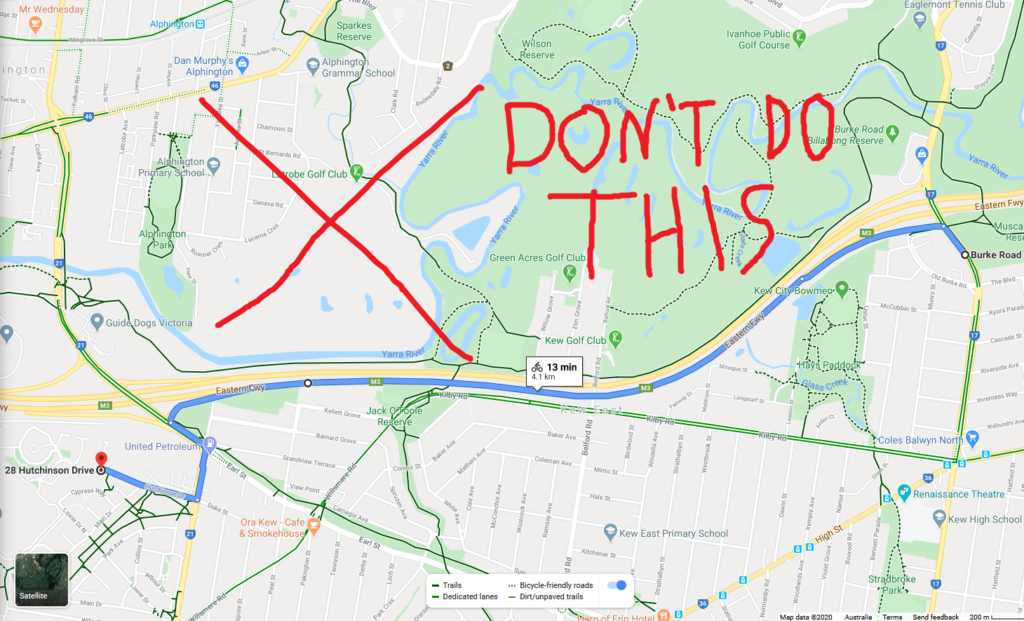
Some had tried to use Google Maps to plan their journey. Unfortunately, as regular riders know, its facilities for bicycle wayfinding are substandard at best and downright dangerous at worst. For example, telling cyclists to ride along the Eastern Freeway to get from North Balwyn to Kew. This is not only highly dangerous but also illegal.

What I can help with
Because of this I am offering to help anyone to plan their journey by bike for free. As a transport planner, regular bike rider and lifelong Melbourne resident I feel able to help you plan a decent route (better than Google Maps anyway…)
I’ll provide you with:
- A route recommendation that is as safe, direct and practical as possible for your needs based on my knowledge and experience
- Turn-by-turn directions (as a cuesheet if you wish)
- And a map of the route of course!
If you’re interested, flick me a message using this form: https://forms.gle/5DzwzEY4hS3rgrsk7
If you don’t want to do that, you can also try using OpenRouteService. It uses OpenStreetMap instead of Google Maps. As a result, it is much more accurate and reliable. It’s still far from perfect and doesn’t benefit from a lot of the local knowledge that can often make a big difference when planning a good bike route, but if you’d like to try it out here’s the link: https://maps.openrouteservice.org/

Leave a Reply