
As construction of one of the world’s biggest road projects continues unabated, I have been doing my best to document its progress.
The $26 billion new North East Link tollway and associated widening of the existing Eastern Freeway is scheduled to be finished by 2028.
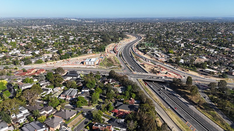
Its massive scale is difficult to overstate. The 10 kilometres of the North East Link itself is in addition to the project scope extending all the way along the entire length of the Eastern Freeway from Hoddle Street to Springvale Road, and the M80 Ring Road from Plenty Road to the Plenty River. It will more than double the width of the road reservation, in many places completely transforming the landscape and surrounding areas.
This photo taken from the bridge over the Eastern Freeway looking towards Bulleen Road gives you a taste of what I mean.

This is what the same area looked like in 2017.

A bit further along on the east side of Bulleen Road, we come across the first of many diversions and disruptions to the Koonung Creek Trail, the main cycling and walking route in this part of the world. I didn’t see a single other person on this section of the Trail when I was there on what was formerly a busy shared path.

The detour takes you around a hairpin bend, down a narrow path and onto local streets.

In many cases, temporary 40km/h speed limits have been installed on detour routes. These have been accompanied by temporary traffic calming measures, including speed cushions and even mini-roundabouts.

I got a bit lost from here and went down the wrong path, ending up on Kosciusko Road (yes it is still spelled incorrectly).
Here there is a massive carpark and staging ground. The vast majority of what was once Koonung Creek Reserve, wetlands and bushland has been occupied by the construction area.

There is so much traffic entering and exiting this area that they have installed a temporary raised priority crossing for the Trail at the driveway.

The further you travel east the more construction work you see.
Here is the view looking east from the Estelle Street Bridge along the Eastern Freeway in 2014.

And here it is today.

One thing you can see to the right of the 2025 photo is part of the new shared path bridge that is being built to replace the original Estelle Street Bridge on which I was standing.
Looking west from the bridge here you can see even more construction work, with the site more than double the existing width of the Eastern Freeway.

Although I couldn’t get an exact photo from the same spot, this is where the wetlands and remnant grassland in the Reserve was located.


Approaching Greythorn Road is another major detour of the Koonung Creek Trail. As of April 2025, the underpass at Doncaster Road is closed. It is scheduled to be like this for at least 18 months.
The underpass itself has been filled with concrete. I’m unsure exactly why – perhaps something to do with its structure?

Further back is a temporary citybound on-ramp for the Eastern Freeway from Doncaster Road. This includes a bus stop (which now only services the 905 and 907) and a pedestrian crossing that can only be used by construction workers to access one of the site gates.

Other bus stops in the area remain closed and more are progressively being shut, making it an increasingly long walk for people to access public transport.

There is a lot more to see along all three roads but I will leave it there for now.
Leave a Reply