
Last week I crossed the Rubicon River on a hike in north-central Victoria. Unlike Julies Caesar, doing so didn’t start a war.
The main reason for this trip was to have a good poke around one of the oldest hydroelectric power stations in the state.
You have probably heard of Hazelwood, Loy Yang and Bald Hills – all power stations of different types in Victoria. The ones that I went to visit, Rubicon, Royston and Rubicon Falls, are a little more obscure.
I’ll be covering more details about the history of the Scheme in a future post. This one will cover my hike and provide tips and details of the trip.
Getting there
Despite my best attempts to plan, the Rubicon Valley is not accessible by public transport. The 684 bus passes along the Maroondah Highway and gets you reasonably close, but the nearest stop in Taggerty is over 18 kilometres away.
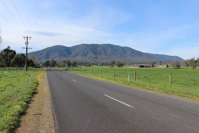
The drive is pleasant, particularly once you get out of the Black Spur just east of Healesville on the Maroondah Highway. The Spur is beautiful and scenic, but the hairpin bends and vans speeding around blind corners in the opposite direction do not make it a relaxing drive at all.
You can drive right up to the base of the Valley where the Rubicon Power Station is located. The road from the entrance to the Historic Area is unsealed but of good quality. I drove up to this point in a small hatchback 2WD without any issues at all.
View Larger Map
Hiking the Rubicon Valley
I hiked a sort of loop that took me past most of the infrastructure with a minimum of doubling back.
[leaflet-map fitbounds]
[leaflet-gpx src=https://philipmallis.com/wp-content/uploads/2019/10/rubicon.gpx color=black]
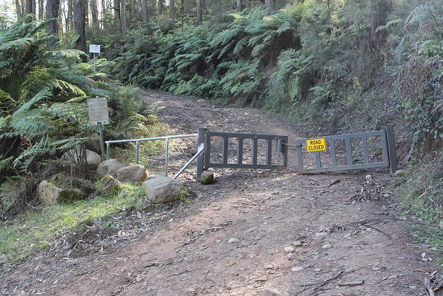
One thing that guides and many other websites fail to mention is the access arrangements for some of the areas. A couple of tracks are restricted during certain times of the year.

Neither the sign nor the Parks Victoria website were clear as to whether this closure refers to vehicles only or to all public traffic. Given that the references on the sign are to “driver safety” and “Four Wheel Drive Clubs”, I took this to mean that it applied only to vehicles.
There are some other tracks that are restricted by AGL or logging companies as well. Again, there were many areas that were unclear as to whether or not public access is actually permitted – such as a large gate being across a path entrance but no sign saying that access is prohibited (which were in other areas). I erred on the side of caution with these particular examples and stayed out.
All up, I think AGL, Parks Victoria and the other authorities responsible for access in this area need better signage to clarify this.
Given that I had selected a public holiday, I wasn’t expecting much company at all. To my surprise, as I approached the base of the mountain range, I saw tens of tents at all of the campsites near the forest. Turns out that it’s quite a popular camping and 4WD activity area.
I headed up Royston Road for my first leg. The first part is quite steep but not too bad. The track is well graded and wide, with only the occassional logging truck or 4WD going by to contend with in terms of traffic.

Unfortunately you can’t see very much of the Royston River – the road is quite a bit higher up the side of the valley. The only point where you can get a good look is at the 3 Kilometre Bridge.

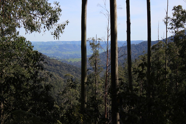
As a bonus, just past this point is where the road begins to turn and creates some good vantage points through the trees to see the view back towards Alexandra.
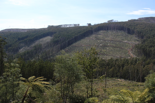
As the earlier truck indicated, there is a large section of former bushland just east of the Rubicon Valley which has been logged extensively over the past few months. Some of the tracks leading in that direction have been shut to the public for this reason.

Once you start to reach the top of the hill, the trees open up on the left and huge areas of former bushland come into view. Freshly-felled trees can be seen littered around the nearby hillsides for as far as the eye can see.
This particular site has been the site of ongoing protests and campaigns in an attempt to stop logging operations in the area – it seems that they have been unsuccessful.
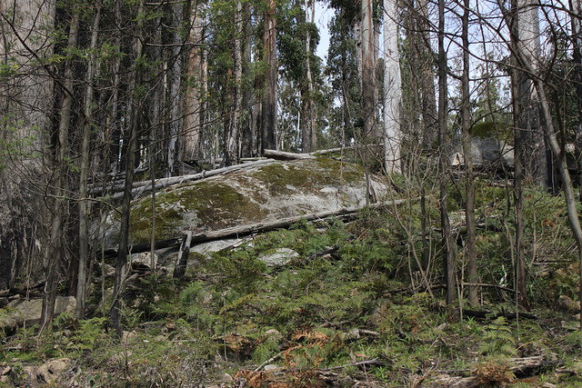
The landscape at the top of the hill near Royston Power Station is noticeably different to that at the bottom. I’m no ecologist or environmental scientist, but my guess is the 500-600 metre difference in altitude. The ground vegetation here is less dense and there are large rocks with beautiful shapes and colours scattered throughout.
I finally reached the Royston Power Station, complete with its rebuilt wooden tramway bridge and almost fully intact tracks.
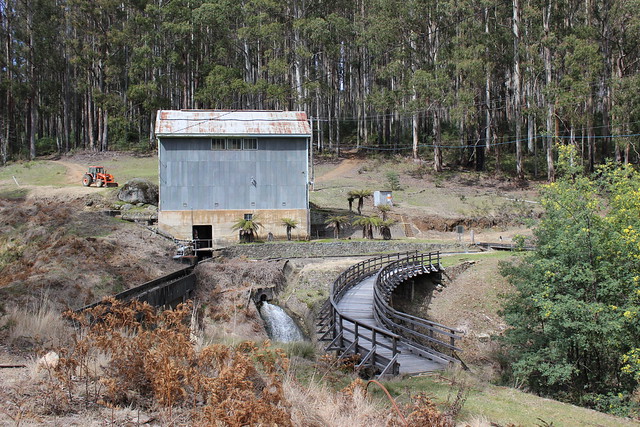
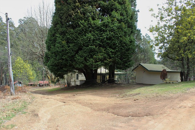
Just around the corner is a small collection of buildings called the Royston Oustation. This includes the Rubicon School Camp and a run-down depot shed for the SEC tramway that follows the acqueduct all the way back to the Rubicon Power Station.
I’ll save the details of this area and the historic sites on my way back down the Valley for my next post about the Hydroelectric Scheme, but suffice to say that it’s very pleasant to wander through this beautiful bushland and stumble across such a large number of intact and historically significant sites.
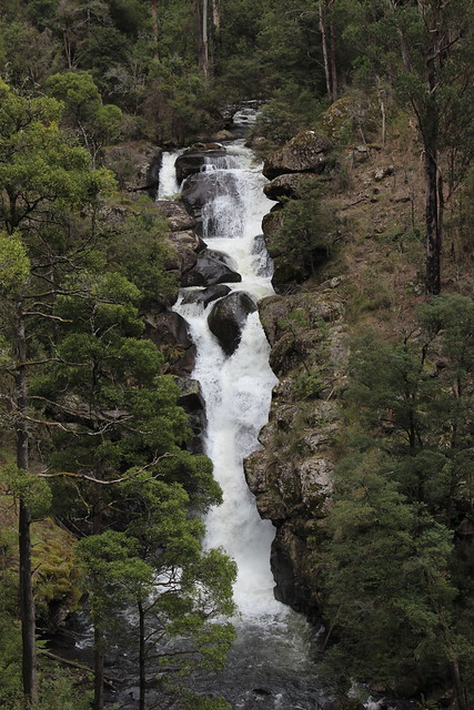
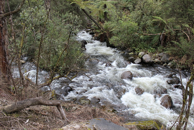
One spot that is definitely worth a stop is the Rubicon Falls. It is just upriver from the Rubicon Dam and hard to miss on account of the roar that you can hear from a good 800 metres away.
By this point, the wind had started to pick up and there was lots of unnerving creaking coming from the upper reaches of the tree canopy. However, because of the wind’s direction and the alignment of the Valley, there was hardly any wind at ground level.
Getting closer to where I began, the road falls down to river level and follows it directly above or next to its eastern bank.
Just before reaching the end of the circuit and the Rubicon Power Station, there is a small path that will take you a little further up the hill towards the end of the SEC tramway and aqueduct. It’s well worth the extra climb as you can get a great view of the valley looking north.

Summary
Even if you are not interested at all in power generation or the history of the area, the Valley and its surrounds are still worth the trip. There doesn’t appear to be that much wildlife, but the scenery is beautiful – the two rivers in particular are something that you don’t get to experience on most hikes.
If you are interested in the areas history, my next post will go into more detail on this aspect of my hike – so stay tuned! If you haven’t already, you can subscribe to receive automatic email updates every time there is a new post here.
Leave a Reply