Tag: map

A new Victorian rail network map for September 2026
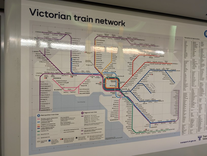
UPDATE: Turns out these maps have been up for months and I just haven’t noticed. On the train yesterday I noticed something a little bit different posted on the wall. Specifically, the Victorian rail (not train) network map. The first thing that caught my eye was the September 2026 ‘effective date’. Given that it is…
Map of bus stops in Maranoa
Something that I have been working on intermittently for a few months is a map of all bus stops in Maranoa (i.e. parts of Balwyn, North Balwyn and Mont Albert North). Given that there isn’t any map that I could find with specific bus stops on it, I thought that this could be a worthwhile…
Map of Balwyn area from 1966 first edition Melway
Found this interesting image from the 1966 edition of Melway of Page 46 – Balwyn, North Balwyn, Surrey Hills and Canterbury. It seems that not that much has changed in almost 50 years… (Source) click to enlarge. You can view the rest of the first edition via a clickable map here: http://melwayed1.melway.com.au/mwyedn1.htm