
UPDATE: Turns out these maps have been up for months and I just haven’t noticed.
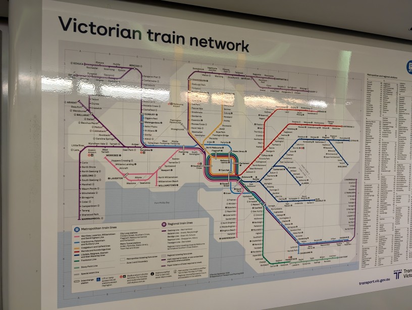
On the train yesterday I noticed something a little bit different posted on the wall. Specifically, the Victorian rail (not train) network map.
The first thing that caught my eye was the September 2026 ‘effective date’. Given that it is still June this made me briefly think that Xtrapolis carriage 280M had been caught in a time warp.

Fortunately, or unfortunately, this was not the case. It seems that this map has gone up prematurely. It’s not a revolutionary change but it does contain a few interesting things.

The biggest change is that the Werribee, Laverton, Williamstown and Sandringham Lines now appear as a single through line.
The current map – effective February 2026 – shows each of these lines terminating at Flinders Street. This is the temporary arrangement from the opening of the Metro Tunnel, with a promise at the time that through running of these lines would commence “later in 2026”.
The new map now refers to the “Werribee, Laverton, Williamstown and Sandringham Lines” as a single pink line in the legend, and the line break at Flinders Street Station has been removed.

If this map is correct, the Werribee, Laverton, Williamstown and Sandringham Lines will combine to run through as a single line from September 2026.
A second change is that West Tarneit Station is shown as complete. The ‘West Tarneit construction completed 2026’ asterisk in the current map has been removed.

There may be some other small differences but these are the ones I noticed.
Unfortunately they didn’t take the opportunity to make the excellent tweaks suggested by Jeremy Burge in this post earlier this year.
It is also interesting that they are posting these three months early while many other trains still have pre-Metro Tunnel maps.
Leave a Reply